Events
QZSS Workshop – ICT Construction for New Clark City23rd The Asia Pacific Regional Space Agency Forum
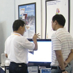
8th MULTI-GNSS ASIA CONFERENCE
EDC GIS Day
Invitation to Datacasting Workshop in Manila
PhilGEOS
Distribution of Data from Advanced Land Observing Satellite 2 (Daichi-2/ALOS-2)
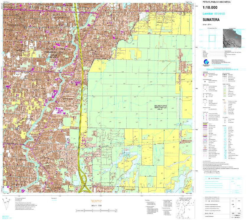
Successful completion of the Aquisition and Production of Geospatial Data for the NSDI, Sumatra Island, Indonesia
Information on The Great East Japan Earthquake 2011
Sentinel Asia Success Story in the Philippines
Asian Development Bank GIS Conference
2009 ESRI User GIS Conference
Philippine Real Estate Festival
Our Social Responsibility
Blood LettingTahanang Walang Hagdanan
CHILD HAUS
Training
Supervising for Continuous ImprovementCross Cultural Awareness Training
Strategic Planning Session
Outdoor Activities
Petron Lakbay Alalay Fun Run 2012PASCOLYPICS 2012
AXN RUNS PHILIPPINES
EVENTS
Corporate Events
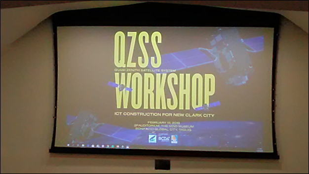
QZSS Workshop – ICT Construction for New Clark City
February 13, 2019 at The Mind Museum Bonifacio Global City, Taguig
The Organizer of the event was the Cabinet Office of Japan and the Co-Organizers were the Bases Conversion and Development Authority (BCDA) and Japan Overseas Infrastructure Investment Corporation for Transport & Urban Development (JOIN).
Speakers were:
- Mr. Vivencio Dizon, President / CEO of BCDA – for the Welcome Remarks and Presentation on “Innovation Approach in New Clark City Development”
- Dr. Takashi Ikeda, Deputy Director of National Space Policy Secretariat, Cabinet Office of Japan – Presentation on “GNSS Innovation in ASIA-PACIFIC Region”
- Dr. Kazuyoshi Tateyama, Professor of Ritsumeikan University for “A New Stage of Construction in Japan, I-Construction, and Expectation of Quasi-Zenith Satellite System”
- Mr. Tsutomu Yoshigi, JOIN – “Smart City Concept and Application For New Clark City”
- Mr. Mitsutomo Nakamura, Manager & Technology Promotion Adviser, International Development Department, Kokusai Kogyo Co., Ltd. (KCC) – for “Cloud Based 3D Data Processing-UAV Application”
- Mr. Mitsutaka Nakamura, Senior Manager, Smart Infrastructure Marketing Department, TOPCON Corporation – “Case Study of ICT Construction”
- Mr. Wonsakorn Chanseawrassamee, Marketing Group, SITECH Japan – “I-Construction, Into the Future”
- Government offices such as Department of Science and Technology (DOST), Department of Public Works and Highways (DPWH), Department of Transportation (DOT), Department of Trade and Industry (DTI), Philippine Contractors Accreditation Board (PCAB), Philippine Space Agency (PSA), National Mapping and Resource Information Authority (NAMRIA).
- BCDA Private Partners
- BCDA Advisors – Asian Development Bank (ADB), Internal Finance Corporation
- Real Estate Developers, Construction Companies, GIS Companies and other private firms.
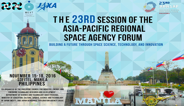
23rd The Asia Pacific Regional Space Agency Forum
15th – 17th November, 2016 at Sofitel Philippine Plaza Manila
The Asia-Pacific Regional Space Agency Forum (APRSAF) was established in 1993 to enhance space activities in the Asia-Pacific region.
Space agencies, governmental bodies, international organizations, private companies, universities, and research institutes from over 40 countries and regions take part in APRSAF, the largest space-related conference in the Asia-Pacific region. The increasing attendance of high-ranking officials at APRSAF events provides opportunities to discuss international cooperation for space activities in concrete terms.
APRSAF currently organizes four working groups—Space Applications, Space Technology, Space Environment Utilization, and Space Education—to share information about the activities and future plans of each country and region in these respective areas. APRSAF also supports the establishment of international projects as solutions for common issues, such as disaster management and environmental protection, so that participating parties will benefit from mutual cooperation.
The event was held at Mindanao, Sofitel Philippine Plaza Manila. It was a 3-day event from November 15-18, 2016. Various Companies including universities, related research institutes, government agencies and International organizations gathered to participate the event.
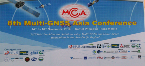
8th MULTI-GNSS ASIA CONFERENCE
14th – 16th November, 2016 at Sofitel Philippine Plaza Manila
The Multi GNSS Asia (MGA) community was established as an international organization to promote the research and industrial activities under the leadership of Japanese Aerospace Exploration Agency (JAXA), Japan, by which a demonstration campaign has been conducted through MGA. This year’s conference main theme was “Providing the Solutions using Multi-GNSS and Other Space Applications in the Asia-Pacific Region” thereby broadening the development of solutions beyond GNSS to include related technologies and applications such as remote sensing and big data analysis relevant for Asia and Oceania countries.
The event was held at Harbor Garden, Sofitel Philippine Plaza Manila. It was a 3-day event from November 14-16, 2016. Various Companies including universities, related research institutes, government agencies and international organizations gathered to participate the event.
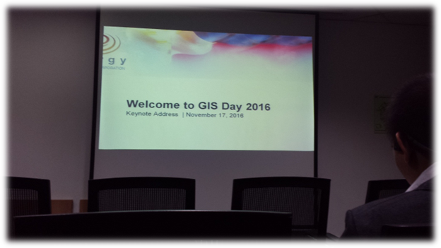
EDC GIS Day
November 17, 2016 at the OML Hall, One Corporate Center Building, Ortigas, Pasig City
Energy Development Corporation held an annual celebration of GIS DAY last November 17, 2016 at their OML Hall of One Corporate Center Building. It was a technology fair filled with exciting and informative talks about the latest topics and technologies in the GIS Industry. It was also a great time for GIS users/vendors, specialists and EDC employees to network and catch up with the current trends on mapping, GIS Technology and it’s applications.
This year’s celebration they adopted the same Global Theme: Discovering the World through GIS. In relation to this, they invited companies inclined in GIS business to set up a booth and to have a moment as a presenter on their technical session.
EDC thought that having this event was a great venue to showcase the experience and expertise as well as the products and services of each companies
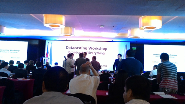
Invitation to Datacasting Workshop in Manila
March 15, 2016 at the Crowne Plaza Manila Galleria Ortigas
Ministry of Internal Affairs and Communications, Japan together with Oriental Consultants Co. Ltd. (Philippines) held an event at Crowne Plaza Manila Galleria Ortigas last March 15, 2016. The event was about “Datacasting Workshop in Manila”. It was attended by various Japanese and Local Firms, Local Government Units (LGUs) and National Agencies.
The opening remarks was made by Mr. Norifumi Yamaguchi of Ministry of Internal Affairs and Communications of Japan, Director for International Digital-TV Policy, Global ICT Strategy Bureau.
Dir. Faulan discussed the importance of technology in disseminating information to the public. She said during her speech “Social Medias like Facebook, Twitter and Instagram make our jobs easy on relying important messages to the public”.
Mr. Kato discussed the relevance of ISDB-T (Integrated Services Digital Broadcasting-Terrestrial) for spreading information. ISDB-T is a broadcasting service which provides:
- Information Services (such as closed caption, commentary & weather/traffic information);
- Interaction function to participate in TV programs such as quiz and questionnaires;
- And navigation systems, computers and mobile phone to enjoy TV programs and receiving disaster information
Mr. Oishi of Honda Motor Co., Ltd., discussed the role of vehicles for the datacasting project. According to him, vehicles such as UV Express, Taxi, and other business cars, by utilizing it can become a useful tool in distributing traffic information.
By uniting the Vehicle and the power of Information and Communications Technology together with Digital Broadcasts, it can provide information such as:
- Real time congestion information using datacasting
- Navigation system provides route to avoid congestion using congestion link information
- Data displaying the state of congestion
- Congestion data to calculate the navigation route
After the first 2 presentations, we had a tea break. It was a good chance of doing a little networking. So here are some of the names of the people we had met and the company or agency where they are connected with.
- Mr. Arialito Manalo – MMDA “Signal”
- Ms. Mercedes B. Suarez – Schema Konsult, Inc.
- Mr. Brian B. Sabalo – Solar Power Utilities Generator Corporation
- Mr. Rex Munsayac – Oriental Consultants Co. Ltd. (Philippines)
- Mr. Enrique Pineda Jr. – DRRMO, Valenzuela City
- Dir. Ma. Josefina Faulan – Metropolitan Manila Development Authority
The Feasibility study and Pilot project was created to find out if Japan experience can be helpful for Philippines and which ICT solution can be contributed to disaster management as well. The duration of the project was set on from April 2014 to March 2015 which NEC took a main role.
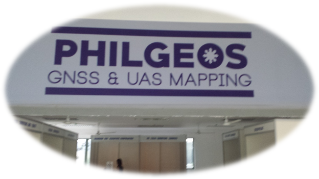
philgeos
November 23 – 26, 2015 at the Institute of Biology Auditorium University of the Philippines Diliman, Quezon City
The University of the Philippines of Geodetic Engineering (UP DGE) and Training Center for Photogrammetry and Applied Geodesy (TCAGP) has been organizing the Philippines Geomatics Symposium since 2012. philgeos is a major gathering of educators, researchers, and the industry leaders in the field of Geomatics from different parts of the country. It is a good venue to share ideas and experiences, to promote growth of Geomatics and foster collaboration among academe, government, industry and other organizations.
This year, UPDGE-TCAGP organized two Special Symposiums under the philgeos: the philgeos – Global Navigation Satellite System (GNSS) and philgeos – Unmanned Aerial System (UAS) Mapping. The philgeos-UAS Mapping Symposium is aimed at disseminating UAS-related studies and various applications of the UAS technology. It will serve as a forum to discuss issues related to applications and regulations on data acquisitions using UAVs.
Distribution of Data from Advanced Land Observing Satellite 2 (Daichi-2/ALOS-2)
September 18, 2015
On November 25, 2014, the Remote Sensing Technology Center of Japan (hereafter "RESTEC") and PASCO CORPORATION (hereafter "PASCO") will jointly begin distribution of data from Advanced Land Observing Satellite 2 (Daichi-2/ALOS-2) and Advanced Land Observing Satellite (Daichi/ALOS/PRISM)(*1) (hereafter "ALOS-2 data, etc.").
The ALOS-2 data, etc., to be distributed is distinguished by its usefulness for many applications, including prompt and detailed grasping of the situation in natural disasters, grasping of the situation in ground subsidence, monitoring of sea ice, and exploration for resources. This project is being conducted as part of a larger project of operation of ALOS-2 and general distribution of observation data, as entrusted to the two companies by the Japan Aerospace Exploration Agency (hereafter JAXA). The intent is to further the expansion of the utilization of the ALOS-2 data, etc.
(*1) Advanced Land Observing Satellite (Daichi/ALOS): A Japanese Earth observation satellite operated from January 2006 to May 2011, performed high-precision global observations and have contributed to creation and updating of maps, grasping of situations for disasters, observation of local environments, etc. Of the three sensors installed on ALOS in this project, the data from the Panchromatic Remote-sensing Instrument for Stereo Mapping (PRISM) sensor is to be sold.
Background
This project is contracted by JAXA to the consortium of RESTEC and PASCO. The purpose is the operation of ALOS-2 and the general distribution of ALOS-2 data, etc. RESTEC is the representative organization, responsible for overall coordination and ALOS-2 mission operation, while Space Engineering Development Co., Ltd. is responsible for satellite control. Meanwhile, PASCO is the data seller, responsible for working with RESTEC to distribute ALOS-2 data, etc.
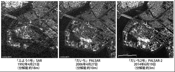
Features of the ALOS-2 data
High-resolution observations
ALOS-2 (PALSAR-2) offers higher-resolution observations compared to ALOS (PALSAR): it can resolve 1 m : 3 m in spotlight mode. Also, it can observe regardless of daylight or weather conditions thanks to its utilization of synthetic aperture radar (SAR). This is useful for grasping in detail such things as the damage situation in natural disasters such as floods and volcano eruptions which are prone to occur in the world. Figure: Comparison of observation images between ALOS (PALSAR) and ALOS-2 (PALSAR-2)
Wide range of observation and improved frequency
ALOS-2 is capable of lateral observation by tilting of the satellite's attitude. Compared to ALOS, the range of observation has tripled to 2,320 km. Moreover, the repeat cycle has gone dramatically down to 14 days. Along with other factors, this enables prompt observation.
How the ALOS-2 data will be distributed in Philippines
The ALOS-2 data, etc. will be distributed through PASCO Philippines Corporation.
Figure: Comparison of observed images between ALOS (PALSAR) and ALOS-2 (PALSAR-2)
Successful completion of the Aquisition and Production of Geospatial Data for the NSDI, Sumatra Island, Indonesia
August 1, 2014
Mr. Kohei Uesugi who is currently appointed as president of PASCO Philippines Corporation is one of the project member, who have successfully completed the Acquisition and Production of Geospatial Data for the NSDI, Sumatra, Indonesia
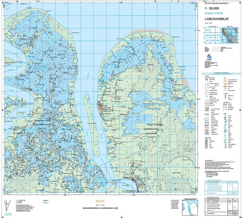
Overview of Sumatra NSDI Project
The Government of the Republic of Indonesia and the Japan International Cooperation Agency (JICA) toward the National Geo-Spatial Data Infrastructure (NSDI) Development formulated and entered into contract in March, 2007. The Government represented by the Agency for Geo-Spatial Information (BIG) concluded a contract for the NSDI Development Project (1P-544): Component 1: Acquisition and Production of Geo-Spatial Data of Sumatra Island with PASCO in December, 2010 and PASCO developed Geospatial data at a scale of 1:50,000 covering 303,439 sq.km of Sumatra Island equivalent to 64% of whole island, and at a scale of 1:10,000 covering 4 cites.
Sumatra Island has tropical rainforest climate and there are difficulties to acquire aerial images by optical cameras due to easy influence of the weather conditions. PASCO therefore acquired the aerial images from X-band Synthetic Aperture Radar (SAR) sensor mounted on the airplane. PASCOs accumulated processing technology of TerraSAR-X satellite since 2007 was utilized for mapping from SAR images. Moreover archived imageries of Advance Land Observation Satellite (ALOS) Daichi, which was in operation from 2006 to 2011, were utilized as the reference information and 300 local engineers were employed for this project to develop the data equal to entire land of Japan (Approx. 377,961 sq.km).
The developed data will be accessible by the concerned government ministries within the national data sharing system in Indonesia. These geospatial data will be applicable toward national land development, natural resources management, environment conservation, and disaster prevention as important infrastructural information.
PASCO will continue to contribute to establish safety and secure society in booming the ASEAN countries such as Indonesia through advanced Geospatial Services.
Sample of geospatial data at 1:50,000 scale
Sample of geospatial data at 1:10,000 scale
Information on The Great East Japan Earthquake 2011
March 31, 2011
Japan's East Earthquake Information, March 31, 2011.
On March 11, 2011, as massive 8.9 magnitute Earthquake hit Northeast Japan. causing many injuries, fires and a ten meter (33ft) tsunami along parts of the country coastline. This heartbreaking news prompted PPC employees to help PASCO Sendai branch by sending relief goods to give them aid in times of disaster.
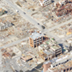
Sentinel Asia Success Story in the Philippines
February 02, 2010
Sentinel Asia Success Story was held in the Philippines and sponsored by JAXA in coordination with RESTEC and technical support by PASCO Corporation and PASCO Philippines Corporation. Technical Training / Field Survey / Workshop Technical training of Sentinel Asia of Philippines was held at Club Morocco Beach Resort in Subic, Zambales on August, 2009. The participants from the governmental agencies of Philippines were gathered to study the applications of natural disasters and know-how of creating hazard maps and image processing with utilizing ALOS satellite images.
On February, 2010, field survey of Mt. Mayon was conducted to increase the positioning accuracy of the hazard maps of Mt. Mayon by collecting X, Y, Z coordinates with GPS devices. Workshops were also held in city of Iloilo and Manila to present the final results of hazard maps created by the governmental agencies of Philippines.
Asian Development Bank GIS Conference
October 12, 2009
The Workshop on Using Advanced Geographical Information System (GIS) and Satellite Development in Asia at ADB office.
Participants for the workshop are the following agencies:
- Cabinet Office of Japan
- JAXA
- University of Tokyo
- PASCO Philippines Corporation
- ADB directors and staff
- Nippon KOEI
- UN Secretary General's Advisory Board on Water and Sanitation (UNSGAB)
- UN Economic and Social Commission for Asia and the Pacific (UNESCAP)
- Grameenphone Ltd.
- FUJITSU Limited
- Center of the International Cooperation for Computerization (CICC)
- Mitsubishi Electric Corporation
- Kokusai Kogyo Co., LTD
PASCO Corp introduced new technology for mapping. With the use of SAR and optical imagery combined with a good system application, produces a powerful GIS tool. PASCO's sensors were introduced and also Lidar cameras and ASNARO, a small, low cost satellite which will be launched in 2011.

2009 ESRI User GIS Conference
October 7 - 8, 2009This year's presentation highlights the importance of data for disaster mapping and a review of present calamity and local hazard mitigation plans.
Philippine Real Estate Festival
Thursday July 23, 2009The Philippine Real Estate Festival - July 23 - 25, 2009 - is an annual event that showcases all types of real estate developments and services under one roof. The Festival will also provide updates and insights on housing and real estate investment in the country from both demand and supply providers and to allow all of us to fully realize that real property is the most, if not the best, investment in the market as it is stable and is unlikely to lose value.