SERVICES
Digital Mapping in 2D / 3D
Digital maps are becoming more and more widely used in our daily lives through car navigation systems and internet searches. These services rely on digital mapping data, and a key factor for enhancing the quality and value of the service is the reliability of the data itself.
PASCO Philippines is capable to meet a wide range of different demands with its latest measurement technologies and data representation. These Maps can be combined with the national census results, commercial statistics, or a companys customer information to provide business solutions.
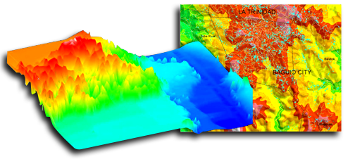
Topographic Terrain Modeling
Tapping on the innovative technologies using Airborne Laser Measuring, PASCO Philippines is able to acquire and process surface data covered by vegetation.
With the measurement of the elevation points at controlled margins of +- 30cm on the horizontal and +- 10cm on the vertical, a highdegree of precision is achieved. Processed as Disaster Simulation, Landscape Simulation, Radio Wave Simulation, Power Transmission Line Planning and derivation of Digital Surface Models.
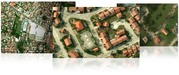
Orthophoto Imaging
Orthophoto imaging is the process of digitially generating images of an aerial photo or satellite images in which displacements caused by camera orientation and terrain is being corrected. The corrected image will then be projected to a standard map projection for spatial accuracy.
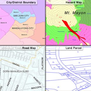
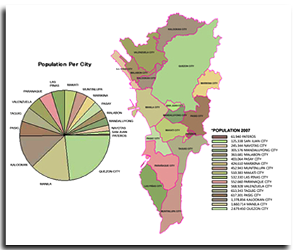
Thematic Mapping
Thematic map is a map that focuses in a specific idea or theme. It illustrates a particular subject and contrasted the general map, in which the variety of geological and geographical phenomena regularly apear together. With thematic maps, one can easily determine the next course of action in business developments, feasibility studies, marketing strategies or wide range planning.
It is especially useful during the preparation stage of a business development design, as it decides the direction where the plan would be going.
It can provide an outlook on the macro-economic climate of a particular location; or with two thematic maps, it can serve as a comparison between the past and the present environment.
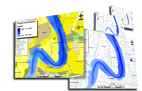
Simulation
Simulated Flood Inundation Area of Marikina City - This 2d map shows the flood simulation along the shore of Marikina river which demonstrate how deep the water level is and shows what barangays, Infrastructure and Land Use are and will soon be affected by the flood.
This simple simulation is a very essential tool for flood and disaster mitigation.
Monitoring
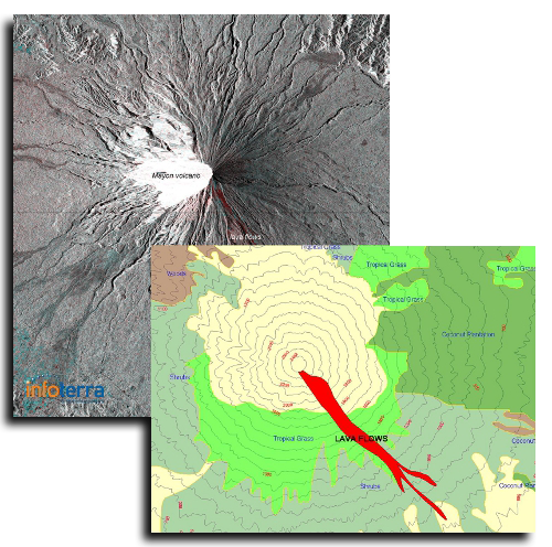
We do pre and post disaster monitoring using deifferent mapping components. Satellite data like TerraSAR and ALOS, combined with our technical capabilities creates accurate data which is very crucial for quick responses or long term planning.
Shown here are different data for monitoring. Maps were combined with elevation data to monitor the mud flow of the Mayon Volcano